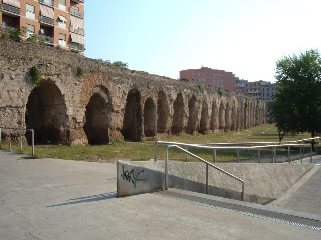
The area of the Centocelle Archaeological Park has been identified as the main experimental site of the CO-Cities project on the Roman territory through a pre-test of the first four phases of the Co-Citty protocol (know, map, develop and practice, prototype) developed within the activities of the laboratory for the governance of the Commons, academic year 2015-2016 (more info here), with the active involvement of university students, local associations, institutions and professionals/ entrepreneurs.
To Know
Before arriving in Centocelle, the actors involved met at different moments of listening and discussion and, through a series of cheap talks (or informal meetings), have been able to identify in different areas of the city a series of common assets relevant to the community and to imagine possible collaborative solutions for their management. In this phase dedicated to knowledge, a series of meetings was held prior to the establishment of the training-intervention and research-action with scholars and experts in areas relevant to the governance of common goods in urban areas, including: Sheila Foster, professor of urban planning law, Paola Cannavò, professor of architecture. Flavia Barca, expert in cultural economics, Massimo Alvisi, architect and tutor of RenzoPiano G124, Michele Sorice, professor of political sociology, Liliana Grasso, expert in business organization and political communication, Silvia Luccarini, sociologist and urbanist, Mattia Diletti, researcher in political science, Enrico Parisio, manager of co-working Millepiani, Luca D’Eusebio, architect and founder of Hortus Urbis, Francesca delle Vergini, expert in public policies for education, Serena Baldari, founder of the space co-working The Hive, the Arch. Maurizio Moretti, master planner of V Municipio and PRINT Cantarini.
These moments of deepening were accompanied by a series of workshops and co-working sessions, through which students acquired the fundamental skills for action research on the governance of the common assets and, divided into working groups, have developed an initial working hypothesis that included a survey of five areas of the city, corresponding to five possible urban cooperation sites, where co-governance can be tested on five different types of common goods. The identified areas (Prenestino-Centocelle, Garbatella, Ostia, Aniene, Appia Antica) have been the subject of an in-depth observation and through data mining and web searches the contacts in the civic, private, institutions and research (taking up the five-fold helical governance model[1]), which will then facilitate the participants in the next phase of mapping.
To Map
The mapping phase was developed through two complementary actions of analog and digital mapping. The work of analog mapping, which has as a starting point the knowledge of territories, population, services, accessibility and mobility, has led to the identification of a series of urban common goods present in the various identified yards and the activities already present on the territory (public, private and civic actors operating, those communities more collaborative and their representatives operating on the territory, therefore able to provide a key to an accurate reading and to analyze the dynamics that take place within it). Complementary to this action on the territory was the digital mapping, which saw the realization of the CO-Roma platform. The creation of a digital tool that promotes an open and collaborative process of reading the territory is a fundamental element of the mapping phase.
The platform is configured as a tool for reading the territory that offers the possibility of adding a good or an experience to the online map through a questionnaire that provides all the information on the object of mapping, and in addition, it performs a function of creation and coordination of the network, operating a synthesis between ideas and projects and involving the various actors, institutional and not, that can assist citizens from the stage of the idea, up to that of project implementation. This last aspect underlines how the development of a digital platform can be important not only in the mapping phase but throughout the process of experimentation and development of theurban governance, as these tools facilitate the activation of processes of collaboration and participation around the common assets in the city.
The shipyard: The Centocelle Archaeological Park
The mapping phase was intended to highlight the limitations and weaknesses of the different experimental practice sites initially envisaged, with the aim of identifying the construction site and the community that in the city had the characteristics suitable for access to the prototyping phase of the governance of common assets in Rome. Through the process of mapping and the subsequent phase of “practicing” (more information here), within which micro-interventions aimed at testing the real presence on the territory of the characteristics identified ex-led to the identification of the “Centocelle Archaeological Park”, located in the V Town Hall, as the most suitable construction site to develop new forms of urban co-governance.
The site has some features that make it particularly suitable for experimenting with practices of regeneration and co-governance of commons. The district of Centocelle is in fact characterized by a series of environmental, social, integration and mobility issues, but at the same time sees the presence of numerous actors who have the potential to become incubators of participatory and collaborative processes. Working in the area of the Archaeological Park also means working on a complex resource, to be valued not only as an urban commons, but also as a natural commons, an archaeological site and part of the cultural heritage. This last aspect is of fundamental importance because it highlights the value attributed to the resource by the community that gravitates around it and recognizes it as a good whose existence and accessibility contributes to the collective well-being. To better understand this component it is useful to refer to the Faro Convention, where cultural heritage is defined as “a set of resources inherited from the past that people identify, regardless of who owns the property, as a reflection and expression of their values, beliefs, knowledge and traditions, constantly evolving. It includes all aspects of the environment that are the result of the interaction over time between populations and places” around which there is a “a community of heritage, made up of a group of people who attach value to specific aspects of cultural heritage, and who wish, within the framework of public action, to support and pass them on to future generations“[2].
This definition allows us to understand how the ongoing experimentation in the site of the Centocelle Archaeological Park has the potential to produce positive developments, not only in terms of cultural and environmental heritage, that needs to be valued and returned to the local community, but also – and above all – from the point of view of benefits for society. The regeneration of the park will allow citizens to regain access to a green area while recreating a place of aggregation and integration, that can be a starting point from which to rebuild the local community and integrate within it even the members of the most marginal groups in the area. Moreover, the opening of the park would allow to connect different areas, and facilitating mobility between the surrounding neighborhoods, and consequently improving the quality of life of residents.
So that experimentation can lead to the achievement of these objectives and, more generally, to the development of a new form of urban co-governance capable of safeguarding urban common goods and tangible and intangible cultural heritage, it is important that the experimentation process in the territory is accompanied by the creation of digital tools Tali strumenti infatti, giving everyone access to transparent and comprehensive information on projects launched in the area and bringing together urban actors sharing the same objective, facilitate the activation of collaborative processes and create new possibilities to preserve, promote and share our rich cultural heritage[3].
[1] The term five-fold governance defines a governance model in which public, private, third sector, cultural institutions such as schools and universities, Individual citizens and social innovators work together to address societal and societal problems.
[2] Art. 2, Council of Europe Framework Convention on the Value of Cultural Heritage for Society, COUNCIL OF EUROPE – (CETS NO. 199) FARO, 27.X.2005 The unofficial Italian translation is available at this link: http://www.ufficiostudi.beniculturali.it/mibac/multimedia/UfficioStudi/documents/1362477547947_Convenzione_di_Faro.pdf
[3] Regarding the role of digital tools in safeguarding and promoting intangible assets, it will be useful to refer to the motion presented in April 2016 to the Parliamentary Assembly of the Council of Europe on the implementation of the Convention for the safeguarding UNESCO’s intangible cultural heritage. More information available at this link: http://diculther.today/patrimonio-intangible-of-europe/ keep reference only if post after April 2016

